In today’s blog, Nina Schlaefli of the University of Bern introduces her poster on steam navigation on Lake Constance, which won second prize in the White Horse Press Poster Competition at ESEH Tallinn this summer. Nina’s poster impressed with its excellent graphical presentation and concisely communicated narrative.
The development of steam navigation on Lake Constance and on the High-Rhine in the nineteenth century has been extensively researched. However, the natural, economic, and political challenges in this process and more particular the environmental dimensions have not yet been sufficiently taken into account.
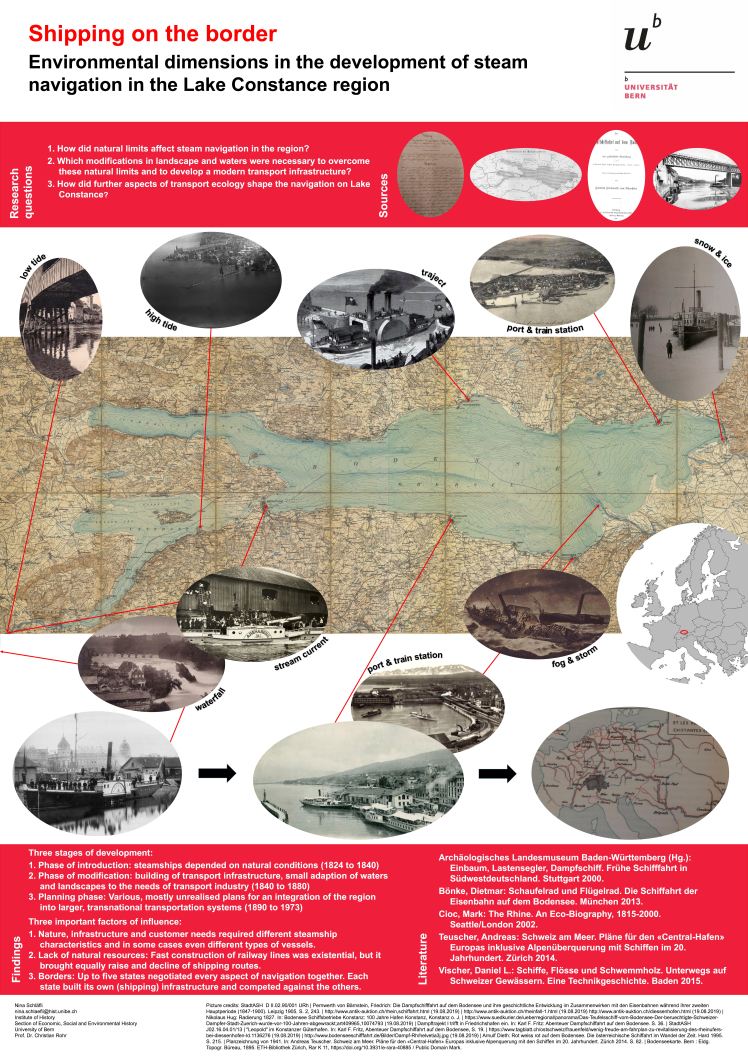
With regard to navigation, the Lake Constance region, reaching from Bregenz to Schaffhausen, must be considered a closed system. The following three reasons emphasise the importance of this region for the history of steam navigation: first, in the nineteenth century, up to five states in different time zones with up to six different steamship companies bordered on Lake Constance. Hence, transnational coordination of navigation was necessary. Every aspect, like safety regulation, had to be negotiated together. Second, nature and infrastructure required different steamship characteristics; if there was not a technological solution, modifications of waters and landscape were often necessary. Third, coal and iron, being the most important resources for steam navigation, were nonexistent in this region and had to be imported from northern regions. Therefore, other carriers and international conflicts permanently affected navigation and indirectly the implementation of bigger infrastructure projects.
Nina’s poster may be accessed as a PDF here: Poster ESEH hoch